admin - Sun, 12/10/2017 - 15:33

On the Sunday of 21st, May, 1994, the "Miri Resort City" Publicity Launch Campaign was launched. The very grand occassion featured lots of shows, grand exhibitions with impressive publicity on what the future of Miri would hold.

 Sarawak had never been particularly rich in railways but it was little known that there was an actual railway laid down in an area called Ensalai, near inland of the Baram River, in 1960.
 Located along China Street, Cathay Cinema was one of the three large purpose-built movie theatres in Miri. Like the other cinemas of the time, the building was basically a large hall with rows of seats within and a small stage at the end, with projector screens on the wall.
 A little history of the Lutong Airfield / Airstrip / Airport
 Piasau Camp was a residential area built in the 1950s for Sarawak Shell for its employees, located on a stretch of the Miri peninsula adjacent to Lutong south from the Lutong airfield.
  The City 'Tram' was introduced in March 2008 in Miri as a free, non-profit service that the Sarawak Tourism Board implemented for tourists and hotel guests to enjoy free public transportation services.
 On Saturday, 6th September 1997, flight BI238, a Dornier 228-212 operating for Royal Brunei Airlines leased from Merpati Intan which plied the Labuan - Bandar Seri Begawan - Miri route on a regular basis, crashed in Lambir Hills.
 The Tomb of Dato Permaisuri that of a legend of a beautiful princess who has settled down in Miri after a shipwreck. In recognition of her unselfish services to the local muslim community, her tomb was gazetted by the Sarawak Government to be part of the Miri heritage.
 2005 Maps, pre-online maps.
 Miri was bombed by U.S. B24 Bombers during World War II. Some video footage of the bombing.
 The Old Fish Market, located in the old town center, is the oldest fish market in Miri.
 On August 1st, 1960, the Miri General Hospital, which had for long been operated by the oil company with financial assistance from the government, was handed over to the government; with it went the Miri Ferry that connects between the peninsular and town - and the hospital -, all the concession land on the Miri Peninsula south of the Miri Golf Course, and all the houses, roads and utility services within that area.
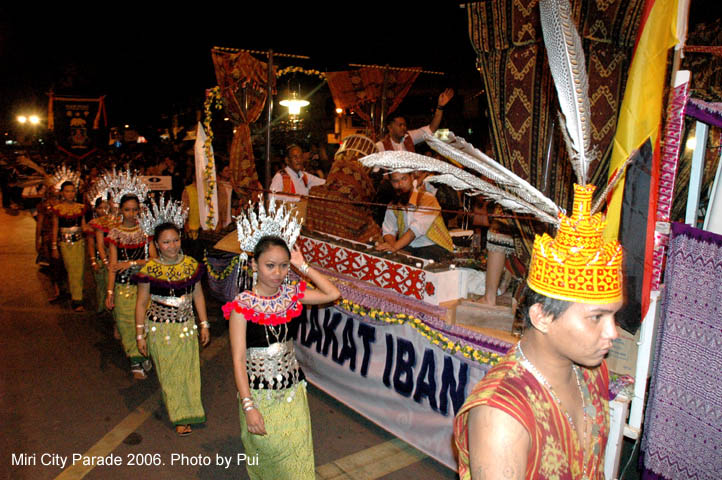 The archive video collection of the historic moments of a once-in-a-lifetime Miri City Parade taken in 2005.
 Literally, Sungai Tujoh is translated as the Seventh River or Seventh Stream spelled in the form of Bruneian Malay language. An immigration post was built in the 1960s to control the movement of goods and people between Miri and points west in Sarawak with Brunei, at this "7th river".
 This is a problem that needs to be addressed. Please don't rely on online maps and the internet by some company from the other side of the world to determine our geography and river names.

 Baram River is a large river that origins hundreds of kilometers inland from the mountains at the border of Sarawak in the heart of Borneo. Baram River is the second longest river in Sarawak.