Miri River is NOT Baong River, and Vice Versa
Primary tabs

This phenomenon needs to be addressed. Thanks to the 'convenience' of online maps by a certain company, a lot of people are calling the Miri River as Baong River. Including news articles like this:

"Man Found Dead Inside Car that Plunged into Baong River - article on Dayak Daily"
..with one of the photos clearly depicting the banks of Miri River banks on the Miri Peninsula.
The writer had simply used a popular online mapping software on their phone and took one look without checking on the correct river name to use.
Twenty years into the 21st century, we seem to have become over-reliant and too naive on having information fed to us by people who don't actually have a clue about our history & geography, and this misinformation seems to be getting worse every single day as people pick up on incorrect information.
There are a lot misinformation on history too floating about the internet on social media, or even offline by word of mouth that it is a very worrying trend.
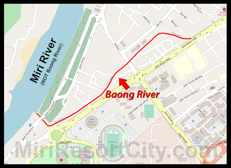
 This is Baong River, shown here connecting to Miri River near Krokop
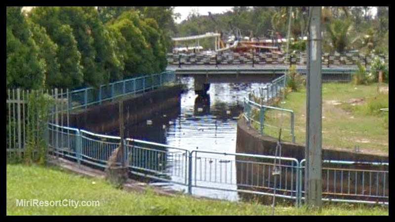
 This photo shows the Miri River in the background, and Baong River is on the lower left of the photo.
OpenStreetMap is a online mapping tool that is built by a community of mappers that contribute and maintain data from all over the world, and tend to be much more reliable than that created by a tech giant from half way around the world.
 Bahasa Sarawak, or Sarawak Language is a common language used by most Sarawakians. English is widely spoken and understood, along Mandarin & major chinese dialects. Miri is proud to boast racial harmony amongst a population of 2.1 million who adhere to a variety of traditions, practices and religions. Sarawak is secular.
 Located in middle of Beautiful Jade Center, Persiaran Kabor, also known as Old Folks' Street (Lao Ren Jie 老人街) is a roofed area in between shoplots where coffeeshops lay out tables and chairs along where folks congregate there for breakfast or tea, drinks, chatting with one another, and passing their time.
 Coco Cabana an event space that is located at the Marina Bay area event space, featuring an art gallery, gift shop, food stalls, cafe and museums.
  Krokop is a large residential area that spans from Jalan Krokop Utama to Jalan Jee Foh and Jalan Krokop 1 Road to Jalan Krokop 10 Road.