Taman Tunku
Primary tabs

 The water tower at Taman Tunku.
Taman Tunku, developed in the mid 1980s and gradually having more residential houses and commercial centers added to it is a large residential area located just beside Miri Airport spanning about 3 kilometers running from north to south with its own commercial centers within.
The area has multiple housing and commercial development within, by various different developers. However as of today there is only really one proper road access to Taman Tunku, which is via the Jalan Tunku Abdul Rahman. The alternative is a dirt road at Jalan Lusut. This results in long traffic queues at rush hours, and if there are any accidents on Jalan Tunku Abdul Rahman access will be bottlenecked. A bypass road was constructed in early 2012 to ease traffic within Taman Tunku and helped some, but this did not really solve the bottlenecking at the main access road.
Taman Tunku has its own Public Library Branch.
#tamantunkumiri
 Miri Central Park is a proposed 15.7-acre urban conceptual park costing RM40 million at the corner of Marina ParkCity at the seafront.
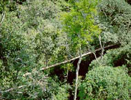 The Lambir Canopy Walkway project was jointly coordinated by Abang Abdul Hamid, an Entomologist with the Forest Department of Sarawak together with the late Professor Tamiji Inoue of the Center for Ecological Research, Kyoto University. ProfessorTamiji Inoue was killed in a plane crash in Lambir Hills National Park.
 The Batang Baram Bridge or ASEAN Bridge is a bridge located along Miri-Baram Highway directly links Sarawak with Brunei across the Batang Baram via the existing Immigration Checkpoint at Sungai Tujuh, which is the check point out of Sarawak and into the country of Brunei.
  Taman Boulevard is a residential area near Boulevard Commercial Center, and is opposite of Faradale Commercial Center.